Services I used
Google Maps: The Ultimate Navigation and Mapping Tool
Imagine navigating a bustling city without ever getting lost, discovering hidden gems effortlessly, and planning your trips with precision all at your fingertips. This isn’t a futuristic dream but a reality made possible by Google Maps. Whether you’re a daily commuter, an avid traveler, or a business owner, Google Maps has revolutionized how we explore and interact with our world.
Introduction
In today’s fast-paced world, reliable navigation is more crucial than ever. Google Maps stands out as the beacon guiding millions through unfamiliar streets and intricate routes. From real-time traffic updates to immersive street views, this tool has transformed the way we travel, work, and discover new places. As we delve deeper into its functionalities, you’ll uncover why Google Maps remains indispensable in our digital era.
What is Google Maps?
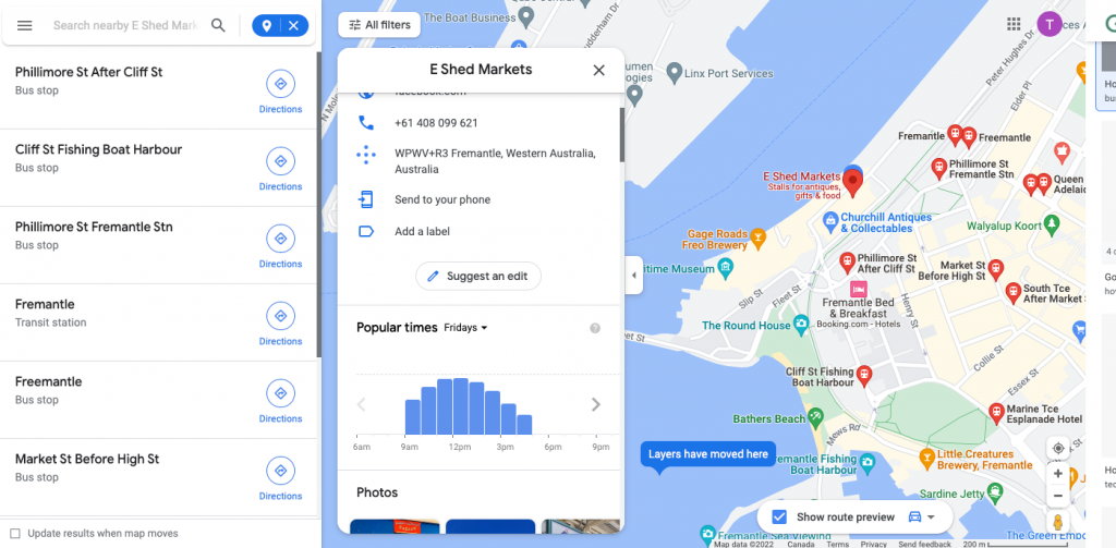
Google Maps is a comprehensive web-based mapping service developed by Google, offering a seamless blend of geographical information, navigation, and local insights. Initially launched in 2005, it has evolved from a simple mapping tool to a multifaceted platform integrating satellite imagery, street views, and real-time data to enhance user experience.
Key Components of Google Maps:
- Satellite Imagery: Provides a bird’s-eye view of locations worldwide, allowing users to visualize landscapes and structures with remarkable clarity.
- Street View: Offers panoramic street-level images captured by specially equipped vehicles, enabling virtual exploration of neighborhoods and landmarks.
- Real-Time Data Integration: Utilizes live traffic updates, public transit schedules, and user-generated content to provide accurate and dynamic navigation solutions.
Comparison Table: Google Maps vs. Traditional Maps
| Feature | Google Maps | Traditional Maps |
|---|---|---|
| \*\*Real-Time Updates\*\* | Yes, including traffic and accidents | No |
| \*\*Interactivity\*\* | Highly interactive with zoom and pan | Static, non-interactive |
| \*\*Search Functionality\*\* | Robust search with filters | Limited to manual scanning |
| \*\*Access\*\* | Online and offline via app | Physical copies only |
| \*\*User Contributions\*\* | Users can add reviews, photos, and edits | None |
Google Maps leverages advanced technologies like artificial intelligence and machine learning to continuously improve its accuracy and functionality. By analyzing vast amounts of data from various sources, it ensures that users receive the most up-to-date information, making it a reliable companion for both everyday navigation and extensive travel planning.
Why Google Maps is the Most Popular Navigation App
Google Maps’ dominance in the navigation app market can be attributed to its extensive feature set, user-friendly interface, and continuous innovation. Since its inception, it has consistently outpaced competitors by offering unparalleled accuracy and a vast array of functionalities that cater to diverse user needs.
Reasons for Popularity:
- Comprehensive Coverage: Google Maps covers virtually every corner of the globe, ensuring that users can navigate both urban and remote areas with ease.
- User-Friendly Interface: Its intuitive design makes it accessible to users of all ages and technical proficiencies, enhancing overall user satisfaction.
- Seamless Integration: Integrates seamlessly with other Google services like Google Calendar and Google Assistant, providing a cohesive ecosystem for users.
- Constant Updates: Regular updates driven by user feedback and technological advancements keep the app relevant and reliable.
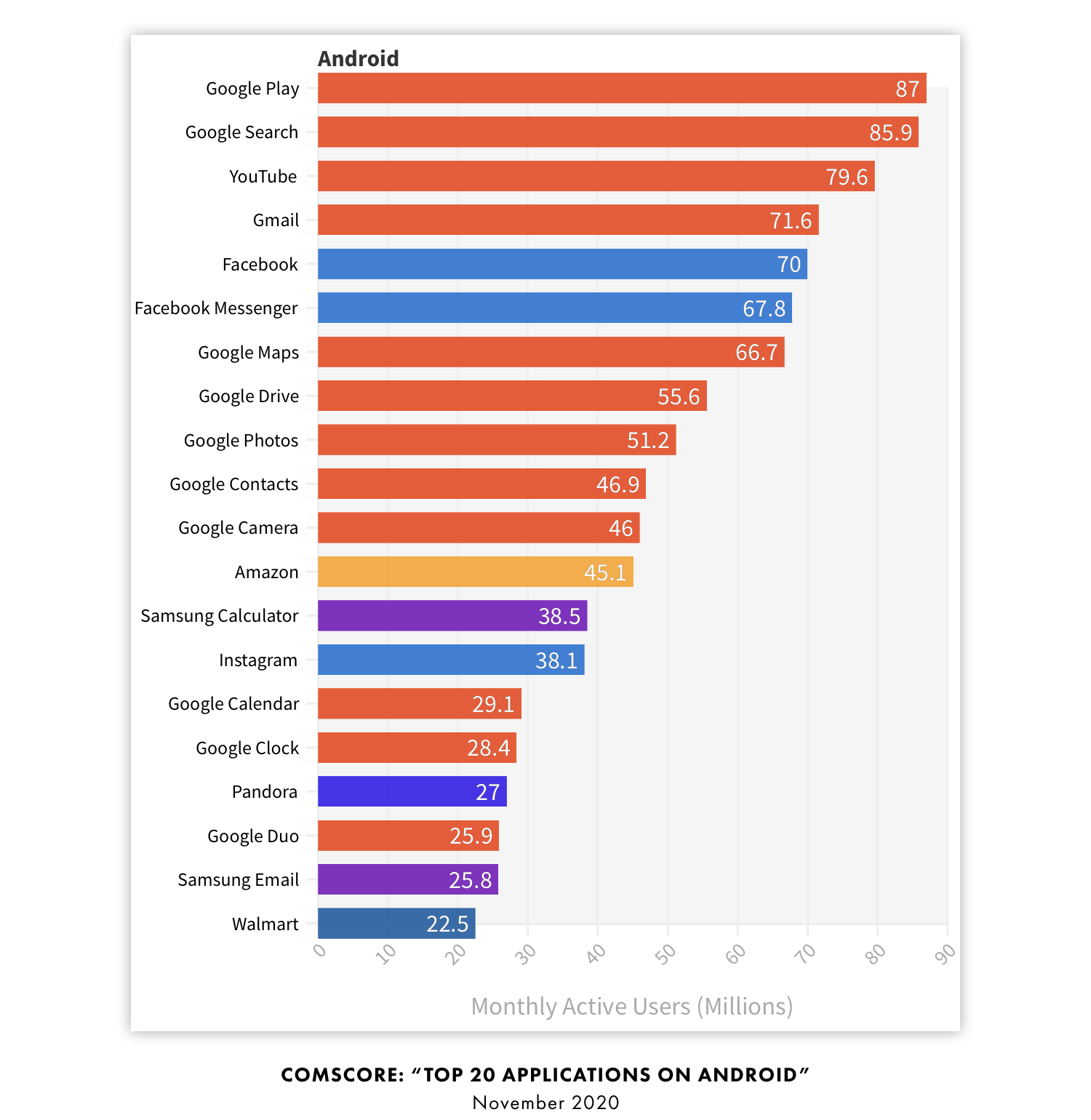
User Feedback and Awards: Google Maps has received numerous accolades, including the prestigious Webby Award for Best Navigation App and continuous high ratings on both Android and iOS app stores. Studies have shown that over 80% of drivers globally use Google Maps as their primary navigation tool, underscoring its widespread acceptance and trustworthiness.
Moreover, Google Maps’ ability to adapt to user needs through features like offline maps and live traffic alerts has cemented its position as the go-to navigation solution. Its competitive edge lies in its comprehensive data accuracy, extensive user base contributing to real-time updates, and the ability to personalize the experience through saved locations and custom maps.
Key Features of Google Maps
Google Maps is not just a simple mapping tool; it’s a sophisticated platform packed with features designed to enhance navigation, exploration, and user interaction. These features cater to a wide range of needs, from daily commuting to extensive travel planning.
Core Features:
- Accurate and Up-to-Date Maps: Leveraging satellite imagery and data from local sources, Google Maps ensures that its maps are reliable and current. This provides efficient routing for driving, walking, biking, and using public transportation.
- Real-Time Traffic Information: The app features real-time updates regarding traffic conditions, enabling users to avoid delays caused by accidents or road work.
- Street View and 3D Maps: Users can virtually explore street-level images and 3D representations of cities, enhancing their navigational experience and familiarity with new locations.
- Offline Maps: Google Maps allows users to download maps for offline use, ensuring navigation capabilities even in areas with poor connectivity.
- Integration with Google Services: Seamlessly connects with other Google services, like Google Calendar and Google Assistant, simplifying the user experience.
- Explore Feature: Recommends local attractions and businesses, helping users discover new places based on their preferences and location.
Comparison List: Google Maps Key Features vs. Other Navigation Apps
| Feature | Google Maps | Waze | Apple Maps |
|---|---|---|---|
| \*\*Offline Maps\*\* | Yes | Limited | Limited |
| \*\*Street View\*\* | Yes | No | Yes |
| \*\*Public Transportation\*\* | Extensive support | Limited | Moderate |
| \*\*Integration with Services\*\* | High (Google ecosystem) | Moderate (Waze features) | High (Apple ecosystem) |
| \*\*User-Generated Content\*\* | Reviews, photos, edits | Real-time traffic and hazard updates | User feedback and reports |
Google Maps continually evolves by incorporating user feedback and advanced data technologies, ensuring it remains at the forefront of navigation and mapping solutions. Its blend of functionality, accuracy, and innovation makes it the preferred choice for millions worldwide.
How to Download and Install Google Maps
Getting started with Google Maps is a straightforward process, whether you’re using an Android device, iOS device, or a desktop computer. By following simple steps, you can access all the powerful features Google Maps offers to enhance your navigation and exploration experiences.
Where to Download Google Maps for Android and iOS
Downloading Google Maps on your mobile device is a seamless process, accessible through the respective app stores for Android and iOS platforms.
For Android Users:
- Open Google Play Store: Locate and launch the Google Play Store app on your Android device.
- Search for Google Maps: Use the search bar at the top to enter “Google Maps” and press enter.
- Download the App: Find Google Maps in the search results and tap the “Install” button. The app will automatically download and install on your device.
- Open the App: Once installed, locate Google Maps in your app drawer, tap to open, and start navigating.
For iOS Users:
- Open App Store: On your iPhone or iPad, launch the App Store.
- Search for Google Maps: Enter “Google Maps” in the search tab and look for the official app.
- Install the App: Tap “Get” or the download icon next to Google Maps. The app will begin downloading and installing.
- Launch Google Maps: After installation, find the Google Maps icon on your home screen, tap to open, and explore its features.
Comparison Table: Download Process on Different Platforms
| Platform | Steps to Download | Additional Notes |
|---|---|---|
| \*\*Android\*\* | Play Store → Search “Google Maps” → Install → Open | Requires Google account |
| \*\*iOS\*\* | App Store → Search “Google Maps” → Get → Open | Requires Apple ID |
| \*\*Desktop\*\* | Use web browser or install PWA via Chrome/Edge | No installation needed for web access |
By leveraging the availability of Google Maps across multiple platforms, users can ensure they have access to reliable navigation tools regardless of the device they use.
Installing and Setting Up Google Maps on Your Device
Once you’ve downloaded Google Maps on your device, the next step is to install and set it up to maximize its functionalities.
Installation Steps:
- Complete the Download: Allow Google Maps to fully download and install on your device.
- Open the App: Tap the Google Maps icon to launch the application.
- Sign In: For a personalized experience, sign in with your Google account. This allows you to save locations, access your search history, and sync data across devices.
- Grant Permissions: Allow Google Maps to access your location, storage (for offline maps), and contacts (optional for sharing locations).
- Configure Settings: Customize your settings by adjusting preferences for notifications, map display (dark/light mode), language, and units of measurement.
Setting Up Key Features:
- Enable Location Services: Ensure your device’s location services are enabled for accurate navigation.
- Download Offline Maps: Navigate to the “Offline Maps” section and select areas you frequently visit to download.
- Customize Your Profile: Add a profile picture and update personal information to enhance the app’s personalization features.
- Set Up Voice Navigation: Configure voice settings for turn-by-turn directions that suit your language and voice preferences.
Tips for Optimal Setup:
- Update the App Regularly: Keep Google Maps updated to access the latest features and improvements.
- Manage Data Usage: Adjust data settings to optimize usage when on limited or expensive data plans.
- Explore Integration Options: Link Google Maps with other apps and services like Spotify for a unified experience during your travels.
By meticulously setting up Google Maps, you ensure that the app functions efficiently, providing you with the most accurate and personalized navigation experience.
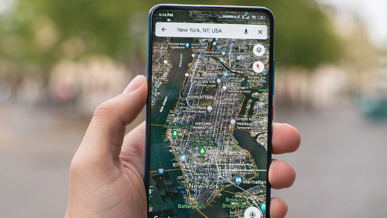
Google Maps for Desktop and Web Browser Access
Google Maps isn’t limited to mobile devices; it’s also accessible via desktop browsers, offering a robust set of features for users who prefer or require a larger screen interface.
Accessing Google Maps on Desktop:
- Open Your Browser: Launch Google Chrome, Mozilla Firefox, Safari, or Microsoft Edge.
- Navigate to Google Maps: Type https://maps.google.com into the address bar and press Enter.
- Sign In: For personalized features, sign in with your Google account.
- Explore Features: Utilize navigation tools, search for locations, and access real-time traffic updates directly from your browser.
Installing Google Maps as a Progressive Web App (PWA):
- Using Google Chrome:
- Go to https://maps.google.com.
- Click on the three dots in the top-right corner of Chrome.
- Select “Install Google Maps” from the menu.
- Confirm the installation by clicking “Install.” Google Maps will now open as a standalone desktop app accessible from your Start Menu.
- Using Microsoft Edge:
- Open Edge and visit https://maps.google.com.
- Click on the three dots in the top-right corner.
- Choose “Apps” and then “Install Google Maps.”
- Confirm by clicking “Install.” The app will open automatically and can be accessed from the Start Menu.
Using an Android Emulator for Desktop: If you prefer the mobile version of Google Maps on your desktop, an Android emulator like BlueStacks can be used:
- Download BlueStacks: Visit BlueStacks and download the emulator.
- Install BlueStacks: Follow the installation instructions provided on the website.
- Access Google Play Store: Open BlueStacks, navigate to the Play Store, and sign in with your Google account.
- Install Google Maps: Search for Google Maps within the emulator and install the app.
- Use Google Maps: Launch the app within BlueStacks to enjoy the mobile version of Google Maps on your desktop.
Comparison Table: Google Maps Desktop vs. Mobile Versions
| Feature | Desktop Version | Mobile Version |
|---|---|---|
| \*\*Interface\*\* | Larger screen, detailed views | Compact, touch-friendly interface |
| \*\*Features\*\* | Similar features with added browser tools | Mobile-specific functionalities |
| \*\*Accessibility\*\* | Accessible via web browser or PWA | Accessible via app stores |
| \*\*Usage Scenarios\*\* | Planning, business use, detailed searches | On-the-go navigation, real-time updates |
Google Maps on desktop offers a powerful platform for in-depth exploration and planning, while the mobile version excels in real-time navigation and on-the-move usability. Together, they provide a comprehensive mapping solution for all user needs.
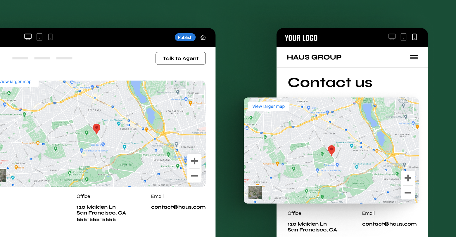
Features and Benefits of Google Maps
Understanding how to download and install Google Maps is just the beginning. The true power of Google Maps lies in its extensive features and benefits, which cater to a wide range of navigation and exploration needs. These features not only simplify daily commutes but also enhance travel experiences, making Google Maps an indispensable tool in our digital lives.
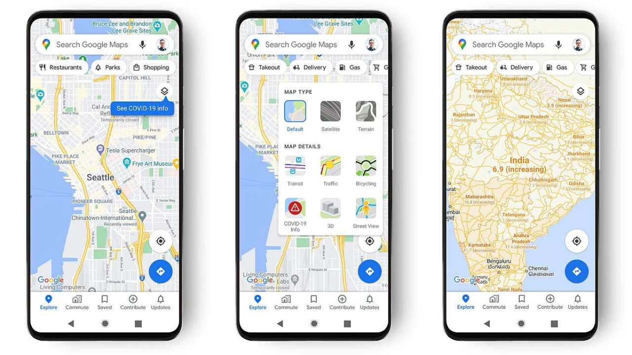
Real-Time GPS Navigation and Route Planning
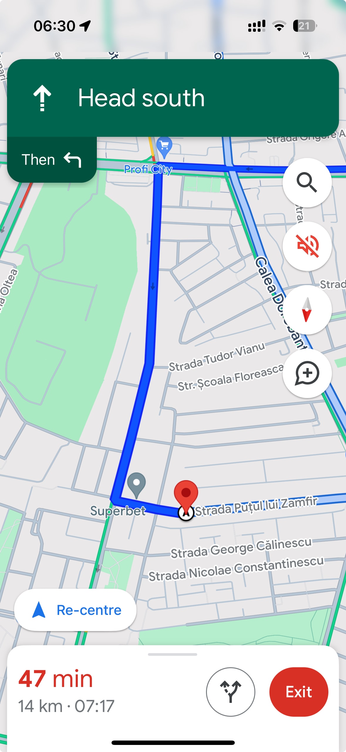
Google Maps excels in providing real-time GPS navigation and route planning, making it an invaluable tool for drivers, walkers, cyclists, and public transit users alike. Leveraging artificial intelligence and vast data repositories, Google Maps offers smarter route planning that adapts to changing conditions.
Key Aspects of Real-Time GPS Navigation:
- Dynamic Route Adjustments: Analyzes live traffic data, road conditions, and user patterns to recommend the most efficient routes.
- Predictive Analytics: Uses historical data and current trends to anticipate traffic jams and suggest alternative pathways proactively.
- Fuel Efficiency: By optimizing routes, Google Maps helps users save time and reduce fuel consumption, contributing to more eco-friendly travel.
- Multi-Stop Routing: Allows users to add multiple destinations, optimizing the order for efficiency and convenience.
Benefits:
- Time Savings: Real-time adjustments help avoid delays, ensuring timely arrivals.
- Stress Reduction: Minimizes the frustration of unexpected traffic and road closures.
- Enhanced Safety: Provides up-to-date information on road hazards, accidents, and construction zones.
Comparison List: Google Maps vs. Traditional GPS
| Feature | Google Maps | Traditional GPS |
|---|---|---|
| \*\*Real-Time Data\*\* | Yes, continuously updated | Limited, often outdated |
| \*\*User Interaction\*\* | Interactive with search and filters | Non-interactive |
| \*\*Integration with Online Services\*\* | High (Google ecosystem) | Low |
| \*\*Customization Options\*\* | Extensive, including personal preferences | Limited |
| \*\*Cost\*\* | Free with internet access | Often requires purchase and updates |
By harnessing the power of AI and real-time data, Google Maps offers a navigation experience that is both intelligent and adaptable, setting it apart from traditional GPS systems.
Live Traffic Updates and Alternative Routes
One of Google Maps’ standout features is its ability to provide live traffic updates and suggest alternative routes in real-time. This functionality ensures that users can navigate around congestion, accidents, and roadworks efficiently.
How Live Traffic Updates Work:
- Data Collection: Aggregates traffic data from millions of users’ devices, GPS signals, and road sensors.
- Traffic Visualization: Uses color-coded overlays to indicate traffic conditions green for free-flowing traffic, yellow for moderate congestion, and red for heavy traffic.
- Proactive Routing: Continuously analyzes traffic patterns to offer alternative routes that can save time and reduce stress.
Benefits:
- Avoid Delays: Users can steer clear of traffic jams, ensuring quicker travel times.
- Optimized Routes: AI-driven suggestions ensure that the chosen route is the most efficient based on current conditions.
- Fuel Savings: Shorter and less congested routes lead to reduced fuel consumption and lower travel costs.
Comparison Table: Google Maps Live Traffic vs. Waze
| Feature | Google Maps Live Traffic | Waze Live Traffic |
|---|---|---|
| \*\*Data Sources\*\* | User devices, road sensors, GPS | Primarily user-generated reports |
| \*\*Traffic Visualization\*\* | Color-coded overlays | Real-time user reports and overlays |
| \*\*Route Suggestions\*\* | AI-driven based on comprehensive data | Community-driven recommendations |
| \*\*Integration with Services\*\* | High (Google ecosystem) | Moderate (Waze-specific features) |
| \*\*Offline Support\*\* | Limited (requires pre-downloaded maps) | Minimal |
While both Google Maps and Waze offer live traffic updates, Google Maps leverages a more extensive data set for its traffic predictions, providing a broader perspective on traffic conditions. This comprehensive approach ensures more accurate and reliable traffic information, making Google Maps a superior choice for live traffic management.
Street View and 3D Mapping for Better Exploration
Google Maps’ Street View and 3D mapping features provide users with immersive visual experiences, allowing them to explore locations virtually before arriving.
Street View:
- Panoramic Imagery: Offers 360-degree images captured by specially equipped vehicles, enabling users to virtually walk through streets and explore their surroundings.
- Detailed Views: High-resolution images provide intricate details of buildings, landmarks, and natural landscapes.
- User Contributions: Allows users to add their own 360-degree photos, enriching the overall map experience.
3D Mapping:
- Realistic Representations: Provides three-dimensional views of cities, enhancing the user’s understanding of the terrain and architectural structures.
- Interactive Exploration: Users can rotate, zoom, and navigate through 3D environments, offering a more engaging exploration experience.
- Application Diversity: Beneficial for urban planning, real estate, tourism, and educational purposes by visualizing complex structures and neighborhoods.
Benefits:
- Enhanced Familiarity: Helps users familiarize themselves with unfamiliar areas, making navigation easier and more intuitive.
- Planning and Decision Making: Assists in planning trips, locating landmarks, and making informed decisions about routes and destinations.
- Visual Discovery: Encourages users to discover new places and attractions through visual exploration, fostering a deeper connection with their surroundings.
Comparison List: Street View vs. 3D Mapping Features
| Feature | Street View | 3D Mapping |
|---|---|---|
| \*\*Imagery Type\*\* | Panoramic street-level photos | Three-dimensional city models |
| \*\*User Interaction\*\* | Navigate streets virtually | Rotate and zoom 3D environments |
| \*\*Primary Use Cases\*\* | Virtual tours, exploration | Urban planning, real estate, tourism |
| \*\*Data Sources\*\* | Google vehicles and user uploads | Satellite and aerial imagery |
| \*\*Customization\*\* | User-added photos and markers | Interactive layers and detail levels |
Google Maps’ ability to provide both Street View and 3D mapping ensures a comprehensive and immersive exploration experience, making it a powerful tool for both casual users and professionals needing detailed geographical insights.

Location Sharing and Saved Places
Google Maps offers robust features for location sharing and managing saved places, enhancing coordination and planning for both personal and professional use.
Location Sharing:
- Real-Time Sharing: Allows users to share their current location with trusted contacts, facilitating easy meet-ups and travel coordination.
- Privacy Controls: Users can choose who can view their location and for how long, ensuring privacy and security.
- Additional Information: Shared locations can include details like recent movement, battery status, and estimated arrival/departure times.
Saved Places:
- Custom Lists: Users can create personalized lists to organize locations based on different criteria such as interests, trips, or regions.
- Quick Access: Easily access frequently visited sites, favorite restaurants, or important business locations without needing to search each time.
- Collaborative Planning: Share saved places with others through links, email, or within the app, enabling collaborative trip planning and discovery of new spots.
Benefits:
- Enhanced Coordination: Simplifies the process of meeting up with friends, family, or colleagues by providing accurate and real-time location information.
- Organized Planning: Helps users keep track of important places, making it easier to plan itineraries and manage daily activities.
- Safety and Peace of Mind: Sharing locations can enhance safety by allowing trusted contacts to monitor movements, especially in unfamiliar or remote areas.
Comparison Table: Google Maps Location Sharing vs. Apple Find My
| Feature | Google Maps Location Sharing | Apple Find My |
|---|---|---|
| \*\*Platform Availability\*\* | Android, iOS, Web | iOS, macOS |
| \*\*Real-Time Updates\*\* | Yes | Yes |
| \*\*Customization Options\*\* | Duration-based sharing, specific contacts | Permanent or temporary sharing |
| \*\*Integration with Other Apps\*\* | High (Google ecosystem) | High (Apple ecosystem) |
| \*\*Additional Features\*\* | Shared ETA, battery status | Location notifications, offline capabilities |
While both Google Maps and Apple Find My offer robust location sharing functionalities, Google Maps provides a more integrated approach within its extensive ecosystem, making it a versatile choice for users across different platforms.
Offline Maps for Traveling Without Internet
One of Google Maps’ standout features is its ability to provide offline maps, ensuring users can navigate even in areas with poor or no internet connectivity.
How to Use Offline Maps:
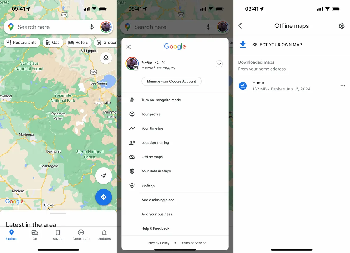
- Download Maps: Before traveling, open Google Maps, tap on your profile picture, select “Offline Maps,” and choose the area you wish to download.
- Manage Offline Maps: Adjust the size of the area or download multiple regions to cover extensive travel destinations.
- Access Without Internet: Once downloaded, access the maps without needing an internet connection, ensuring you have navigation capabilities at all times.
Benefits:
- Reliable Navigation: Navigate without worrying about data expenses or connectivity issues, especially in remote or international locations.
- Consistent Access: Access essential turn-by-turn directions, search for locations, and view maps even when offline.
- Enhanced Usability: Ideal for travelers who may face data restrictions or high roaming charges, making it a cost-effective solution for navigation.
Comparison List: Google Maps Offline vs. HERE WeGo Offline
| Feature | Google Maps Offline | HERE WeGo Offline |
|---|---|---|
| \*\*Download Method\*\* | Select specific areas manually | Download entire countries or regions |
| \*\*Map Precision\*\* | High detail with recent data | Comprehensive coverage with detailed maps |
| \*\*Offline Functionality\*\* | Turn-by-turn directions, search | Turn-by-turn directions, public transit |
| \*\*Storage Requirements\*\* | Requires manual selection and space | More storage-efficient for large areas |
| \*\*Integration with Online Features\*\* | Seamless switch when online | Limited when offline |
While both Google Maps and HERE WeGo offer robust offline navigation capabilities, Google Maps provides a more user-friendly approach with the ability to download specific areas as needed. However, HERE WeGo excels in allowing users to download entire regions, making it a better choice for extensive travels without worrying about missing coverage.
Google Maps for Different Use Cases
Google Maps is a versatile tool that caters to a myriad of navigation and mapping needs. Whether you’re driving, using public transportation, walking, biking, or managing a business, Google Maps offers tailored solutions to enhance your experience.
Google Maps for Driving – Best Routes and Traffic Alerts
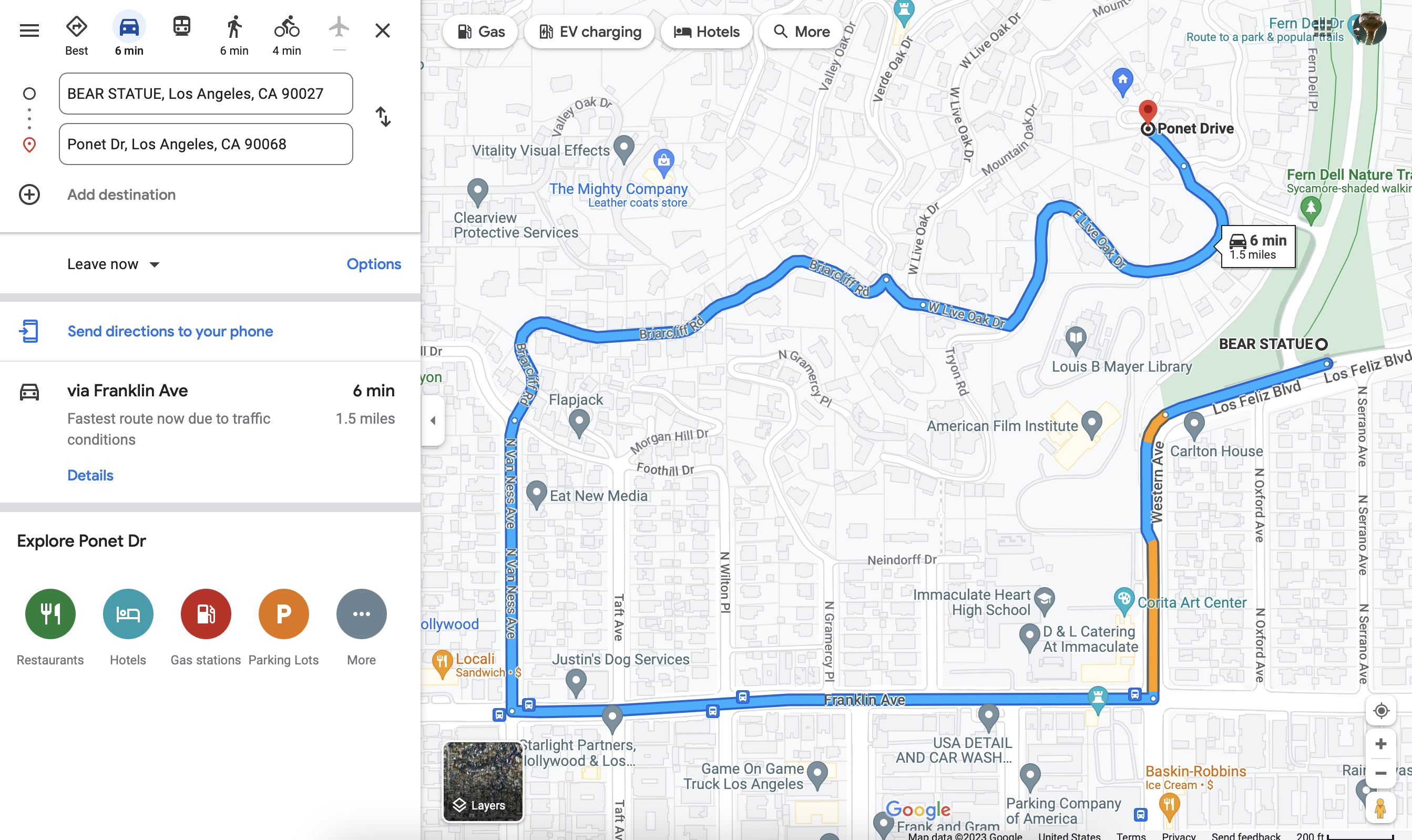
For drivers, Google Maps provides a suite of features designed to make every journey smoother and more efficient. From finding the best routes to staying informed about traffic conditions, Google Maps is an indispensable driving companion.
Best Route Selection:
- AI-Driven Recommendations: Utilizes artificial intelligence to analyze real-time traffic data, road conditions, and historical patterns to suggest the most efficient routes.
- Predictive Traffic Insights: Anticipates traffic patterns based on time of day and typical congestion points, allowing drivers to plan ahead.
- Fuel-Efficient Routing: Optimizes routes not just for speed but also for fuel efficiency, helping users save on gas expenses.
Traffic Alerts:
- Real-Time Updates: Provides instant notifications about traffic jams, accidents, and road closures, ensuring drivers can adjust their routes promptly.
- Hazard Reporting: Integrates community-driven reports about hazards like potholes, debris, or sudden roadworks, enhancing safety.
- Dynamic Rerouting: Automatically suggests alternative routes when significant delays are detected, minimizing travel time.
Additional Driving Features:
- Lane Assistance: Guides drivers through complex intersections with lane guidance, ensuring smooth transitions.
- Voice Navigation: Offers clear voice commands for turn-by-turn directions, allowing drivers to keep their hands on the wheel and eyes on the road.
- Integration with Vehicle Systems: Compatible with Android Auto and Apple CarPlay, enabling seamless integration with vehicle infotainment systems.
Benefits:
- Time Savings: Efficient route planning and dynamic traffic alerts help reduce travel time.
- Enhanced Safety: Real-time hazard reporting and lane assistance contribute to safer driving conditions.
- Cost Efficiency: Fuel-efficient routing lowers fuel consumption and travel costs over time.
Comparison Table: Google Maps vs. Traditional Navigation Systems for Driving
| Feature | Google Maps | Traditional GPS Systems |
|---|---|---|
| \*\*Real-Time Traffic\*\* | Yes | Limited or no |
| \*\*Dynamic Rerouting\*\* | Yes | Rarely |
| \*\*Voice Navigation\*\* | Highly customizable | Basic voice commands |
| \*\*User Interface\*\* | Interactive, touch-friendly | Physical buttons, less intuitive |
| \*\*Cost\*\* | Free, with internet access | Often requires purchase and updates |
Google Maps’ comprehensive driving features, combined with its ability to provide real-time traffic information and dynamic route adjustments, make it a superior choice compared to traditional GPS systems. Its integration with other Google services and continuous updates ensure that drivers receive the most accurate and efficient navigation assistance possible.
Google Maps for Public Transportation – Bus and Train Schedules
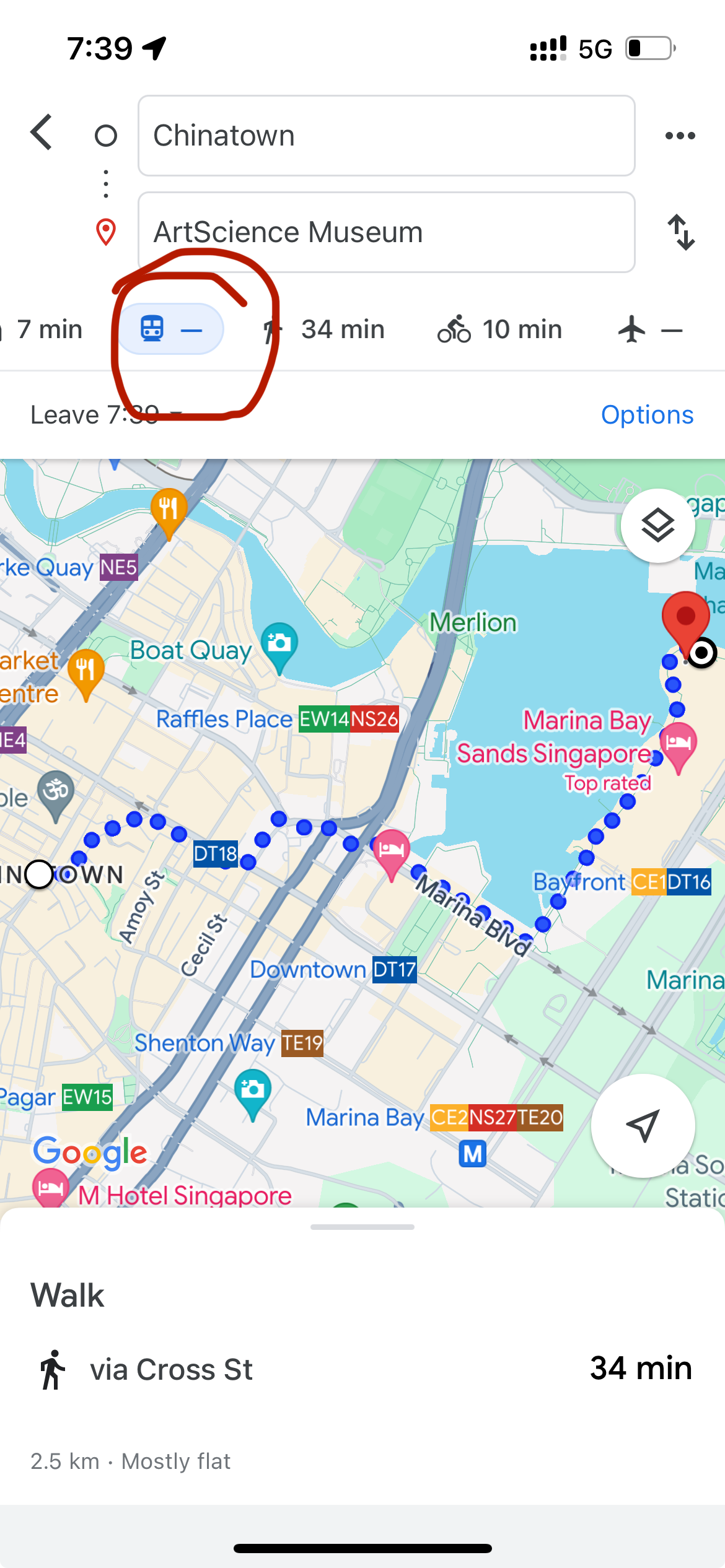
Navigating public transportation systems can be challenging, especially in unfamiliar cities. Google Maps simplifies this process by offering detailed bus and train schedules, ensuring users can plan their journeys with confidence and ease.
Public Transportation Features:
- Comprehensive Schedules: Provides up-to-date schedules for buses, trains, subways, and other public transit options, ensuring users have accurate departure and arrival times.
- Route Planning: Suggests the best routes using public transportation, including transfers, walk times, and estimated travel durations.
- Real-Time Updates: Integrates real-time information about delays, cancellations, and service changes, allowing users to adjust their plans accordingly.
- Transit Alerts: Sends notifications about significant changes in transit schedules or unexpected disruptions, keeping users informed on the go.
Multimodal Transport Integration:
- First and Last Mile Solutions: Combines public transit directions with biking or ridesharing options to cover the “first and last mile” of a journey, enhancing overall convenience.
- Cycling Paths Integration: Highlights bike-friendly routes leading to and from transit stations, promoting eco-friendly commuting options.
- Rideshare Integration: Seamlessly incorporates rideshare services like Uber and Lyft into transit directions, providing flexible transportation alternatives.
Walking Navigation:
- Pedestrian-Friendly Routes: Offers dedicated walking directions that prioritize pedestrian pathways, ensuring safe and efficient navigation for walkers.
- Points of Interest: Highlights nearby landmarks, restaurants, and attractions, making it easier for users to explore their surroundings on foot.
Benefits:
- Efficient Planning: Streamlines the process of planning trips using public transportation, saving users time and reducing the complexity of navigating transit systems.
- Cost Savings: Optimizes routes to minimize travel time and costs, whether by avoiding unnecessary transfers or selecting the most economical transit options.
- Environmental Impact: Encourages the use of public transportation and eco-friendly commuting methods, contributing to reduced carbon emissions.
Comparison List: Google Maps Public Transportation Features vs. Transit Apps
| Feature | Google Maps Public Transportation | Dedicated Transit Apps |
|---|---|---|
| \*\*Comprehensive Coverage\*\* | Extensive global coverage | Limited to specific cities or regions |
| \*\*Integration with Other Modes\*\* | High (biking, rideshare, walking) | Varies |
| \*\*Real-Time Updates\*\* | Yes, integrated seamlessly | Yes, but may require separate apps |
| \*\*User Interface\*\* | Unified with other Google Maps features | Specialized but fragmented |
| \*\*Cost\*\* | Free | Free, some with premium features |
While dedicated transit apps may offer more specialized features for specific cities, Google Maps provides a more holistic and integrated approach to public transportation navigation. Its ability to combine multiple modes of transport and offer real-time updates across a vast number of locations makes it an indispensable tool for public transit users worldwide.
Google Maps for Walking and Biking Navigation
For those who prefer walking or biking, Google Maps offers tailored navigation options that enhance the experience by prioritizing pedestrian and cyclist-friendly routes. These features ensure safe, efficient, and enjoyable commutes and explorations.
Walking Navigation Features:
- Pedestrian Paths: Highlights sidewalks, pedestrian crossings, and pedestrian-only routes to ensure safe walks.
- Step-by-Step Directions: Provides clear, turn-by-turn walking instructions, including landmarks and notable points of interest.
- Accessibility Information: Indicates routes that are wheelchair accessible and includes details about ramps, elevators, and other accessibility features.
Biking Navigation Features:
- Bike Lanes and Trails: Shows designated bike lanes, trails, and bike-friendly streets to promote safe cycling.
- Elevation Profiles: Offers elevation information to help bikers prepare for uphill or downhill segments.
- Bike-Friendly Routes: Suggests routes that minimize traffic exposure and utilize bike paths, ensuring a smoother and safer ride.
Additional Features:
- Estimated Travel Time: Provides accurate time estimates based on walking or biking speeds, helping users plan their trips effectively.
- Health and Fitness Integration: Syncs with fitness apps to track distance walked or biked, contributing to personal health goals.
- Local Recommendations: Suggests nearby cafes, parks, and landmarks, encouraging users to explore and enjoy their surroundings.
Benefits:
- Safety Assurance: Prioritizes routes that are safer for pedestrians and cyclists, reducing the risk of accidents.
- Route Optimization: Ensures efficient paths that save time and energy, whether by avoiding hilly terrains or busy intersections.
- Enhanced Exploration: Encourages users to explore new areas on foot or by bike, fostering a deeper connection with their environment.
Comparison Table: Google Maps Walking and Biking vs. Strava
| Feature | Google Maps Walking and Biking | Strava |
|---|---|---|
| \*\*Navigation\*\* | Yes, with step-by-step directions | Limited, primarily for tracking |
| \*\*Route Planning\*\* | Optimized for safety and efficiency | User-generated routes and challenges |
| \*\*Integration with Fitness Apps\*\* | Basic sync capabilities | Extensive integration with fitness data |
| \*\*Community Features\*\* | Limited to reviews and tips | Strong community engagement |
| \*\*Cost\*\* | Free | Basic free with premium options |
While Strava excels in fitness tracking and community-based challenges, Google Maps provides a more integrated navigation solution for walking and biking. Its ability to offer safe, optimized routes combined with real-time information makes it a superior choice for navigating on foot or by bike.
Google Maps for Businesses – Local Listings and Reviews
Google Maps is not only a navigation tool but also a powerful platform for businesses to establish their online presence, connect with customers, and enhance their visibility in local searches. By leveraging Google Maps’ business features, companies can attract more customers and build a strong local reputation.
Local Listings:
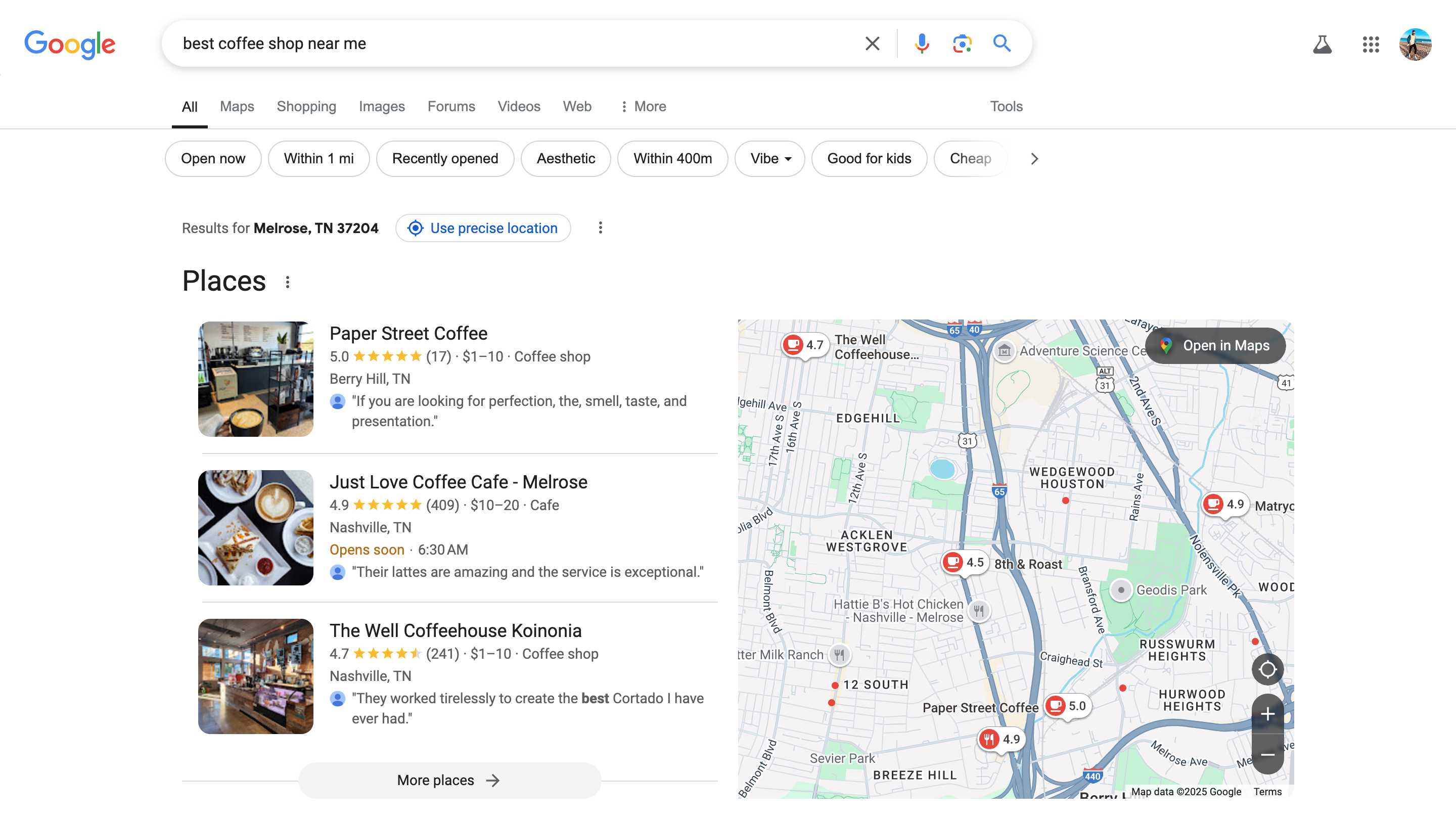
- Google Business Profile: Businesses can create and manage their Google Business Profile, providing essential information like address, contact details, operating hours, and services.
- Accurate Information: Ensures that potential customers have up-to-date and accurate information about the business, reducing confusion and enhancing trust.
- Visual Content: Allows businesses to upload photos and videos, showcasing their products, services, and ambiance to attract more visitors.
Customer Reviews:
- Feedback Mechanism: Customers can leave reviews and ratings based on their experiences, providing valuable feedback for businesses.
- Reputation Management: Businesses can respond to reviews, addressing concerns, thanking customers, and demonstrating commitment to quality service.
- Enhanced Visibility: Positive reviews and high ratings boost the business’s ranking in local search results, increasing visibility and attracting more customers.
Promotions and Updates:
- Posting Updates: Businesses can post updates about promotions, events, new products, and special offers, keeping their profile active and engaging.
- Insights and Analytics: Provides businesses with insights into how customers interact with their listings, including views, interactions, and engagement metrics.
- Ad Integration: Option to run localized ads directly on Google Maps, targeting specific demographics and increasing reach.
Benefits:
- Increased Visibility: Enhances the business’s presence in local searches, making it easier for potential customers to find them.
- Customer Engagement: Facilitates direct interaction with customers through reviews and updates, building stronger relationships.
- Trust and Credibility: A well-maintained profile with positive reviews establishes trust and credibility, encouraging more foot traffic and online interactions.
Comparison List: Google Maps Business Features vs. Yelp
| Feature | Google Maps Business Features | Yelp |
|---|---|---|
| \*\*Profile Management\*\* | Comprehensive and integrated | Focused primarily on reviews |
| \*\*Visual Content Upload\*\* | Yes, photos and videos | Yes, photos only |
| \*\*Customer Interaction\*\* | Respond to reviews, post updates | Respond to reviews, limited updates |
| \*\*Search Integration\*\* | High within Google ecosystem | Independent search platform |
| \*\*Analytics and Insights\*\* | Detailed insights on interactions | Basic review statistics |
While Yelp is renowned for its extensive review system, Google Maps offers a more integrated suite of business features that combine reviews with comprehensive profile management and seamless integration within the broader Google ecosystem. This makes Google Maps a more versatile and powerful tool for businesses seeking to enhance their local presence and connect with customers effectively.
Customizing and Enhancing Google Maps Usage
Google Maps isn’t a one-size-fits-all tool; it offers a range of customization options and enhancements that allow users to tailor their navigation and exploration experience to their specific needs. Whether you’re planning a trip, organizing your daily activities, or managing a business, these customizable features make Google Maps an even more powerful tool.

Creating and Saving Custom Maps
Google Maps empowers users to create and save custom maps, providing a personalized approach to trip planning, event coordination, and location tracking. These custom maps offer flexibility and detail that standard maps cannot, making them ideal for a variety of use cases.
Google My Maps:
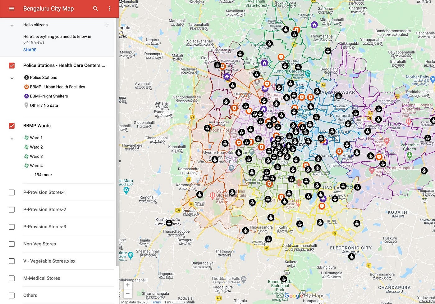
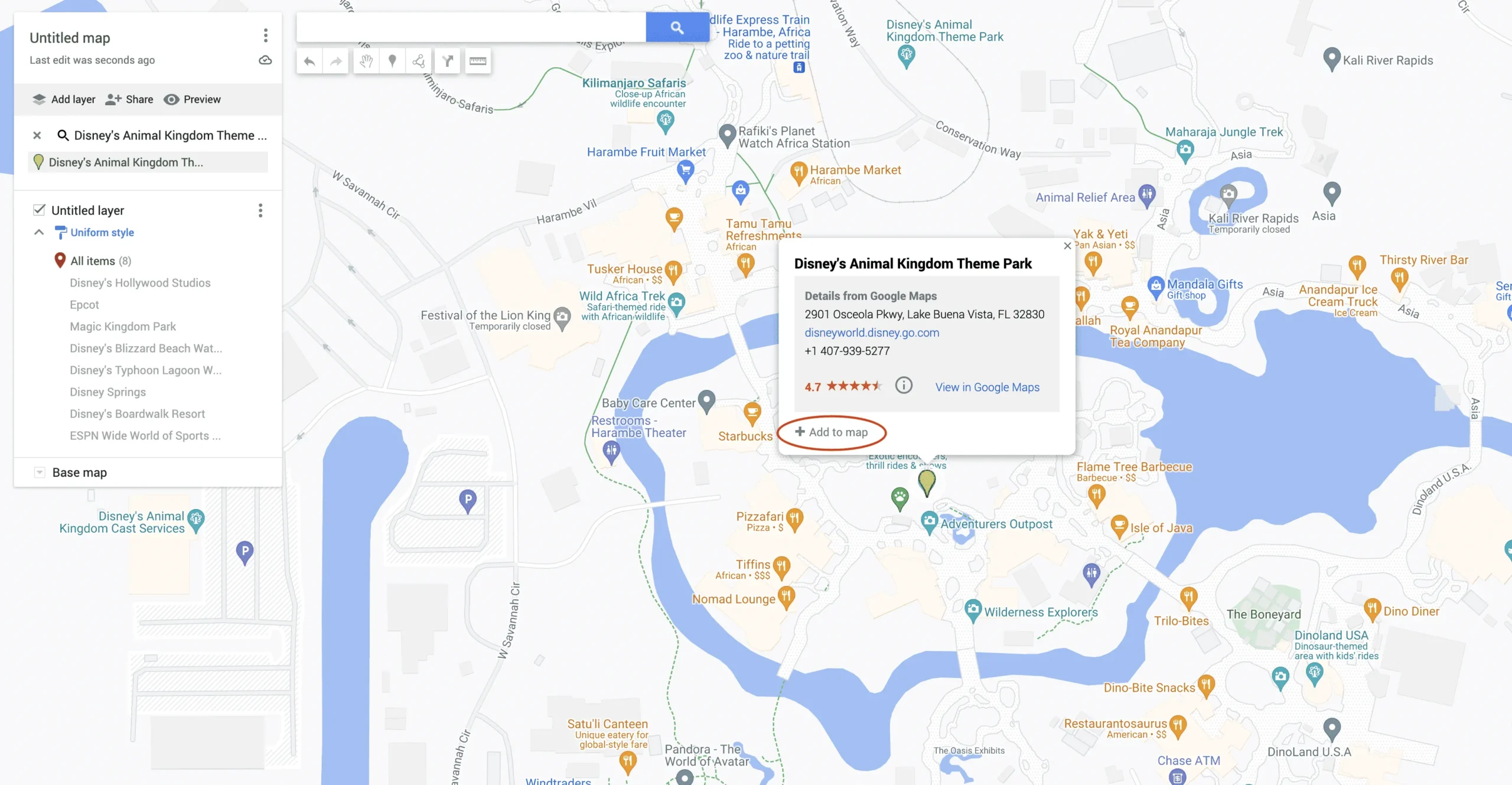
- Create New Maps: Visit Google My Maps and click “Create a New Map” to start building your custom map.
- Add Locations: Click on “Untitled Map” to rename your map and begin adding locations by searching for places and adding markers.
- Customize Markers: Use different icons and colors to categorize locations based on their type or significance, enhancing visual organization.
- Layers Management: Create multiple layers to manage different sets of locations or activities, such as day-by-day travel itineraries or separate business locations.
- Draw Routes: Use the drawing tools to highlight specific routes or areas of interest, providing clear navigation paths for events or trips.
Google Maps Timeline:
- Travel History: Utilize Google Maps Timeline to track past routes and trips based on your Location History, creating a visual record of your travels.
- Edit and Manage: Edit your Timeline by deleting specific entries or adjusting travel locations, ensuring your history remains accurate and up-to-date.
- Customization Options: Customize your Timeline by adding notes or photos to specific trips, creating a rich travel diary experience.
Benefits:
- Personalized Planning: Custom maps allow for detailed and personalized trip planning, ensuring that all important locations and routes are accounted for.
- Collaborative Sharing: Share custom maps with friends, family, or colleagues, facilitating collaborative planning and enhancing group travel experiences.
- Efficient Organization: Manage multiple locations and routes efficiently, whether for personal use, business operations, or event coordination.
Comparison Table: Google My Maps vs. Traditional Map Planning
| Feature | Google My Maps | Traditional Map Planning |
|---|---|---|
| \*\*Customization\*\* | High, with layers and custom markers | Limited customization |
| \*\*Collaboration\*\* | Easy sharing and collaborative editing | Difficult, requires physical sharing |
| \*\*Accessibility\*\* | Accessible online and offline | Requires physical maps |
| \*\*Integration with Google Services\*\* | Seamless with other Google tools | None |
| \*\*Search and Update\*\* | Real-time search and updates | Manual updates and scanning |
Google My Maps offers a dynamic and interactive way to plan and organize trips, events, and business operations. Its integration with Google services and the ability to share and collaborate make it a superior choice compared to traditional map planning methods.
Using Google Maps Timeline to Track Travel History
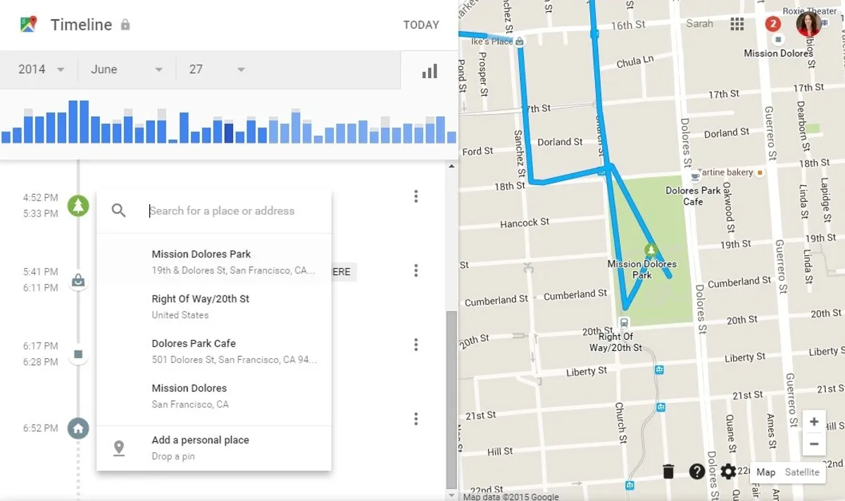
Google Maps Timeline is a powerful feature that allows users to review their past travels and trips, offering a detailed visual record of their journeys. This feature acts as an automatic travel diary, providing insights into where you’ve been and how you’ve moved through different locations.
Accessing Timeline:
- Open Google Maps: Ensure you’re signed in with your Google account.
- Tap on Your Profile Picture: Located in the top-right corner.
- Select “Your Timeline”: Navigate to view your past travels.
Features of Timeline:
- Daily Logs: View day-by-day records of your movements, including routes taken, modes of transportation used, and places visited.
- Trip Summaries: Access summaries of specific trips, detailing start and end points, total distance traveled, and duration.
- Edit and Manage: Adjust your Timeline by deleting inaccurate entries, adding notes, or correcting locations to maintain an accurate travel history.
- Location History Settings: Manage your Location History by turning it on or off, and controlling which location data is stored.
Benefits:
- Personal Memory Aid: Relive memorable trips and trips through detailed visual histories, enriching personal experiences.
- Travel Planning: Use past travel data to plan future trips more efficiently by understanding routes and travel times.
- Health and Fitness Tracking: Combine Timeline with fitness tracking apps to monitor distances walked or biked for health goals.
- Security and Safety: Provides a record of your movements, which can be useful in case of emergencies or lost devices.
Comparison List: Google Maps Timeline vs. Manual Travel Journals
| Feature | Google Maps Timeline | Manual Travel Journals |
|---|---|---|
| \*\*Automation\*\* | Automatic tracking and logging | Manual entry and updating |
| \*\*Detail Level\*\* | High, with precise location data | Variable, based on manual input |
| \*\*Accessibility\*\* | Easily accessible on multiple devices | Limited to physical copies |
| \*\*Search Functionality\*\* | Easy search and filter options | Requires manual searching |
| \*\*Integration with Other Apps\*\* | High (syncs with Google services) | None |
Google Maps Timeline offers a seamless and automated way to track and review your travel history, providing significant advantages over traditional manual journaling methods. Its ability to accurately log and visualize data makes it an invaluable tool for both personal and professional use.
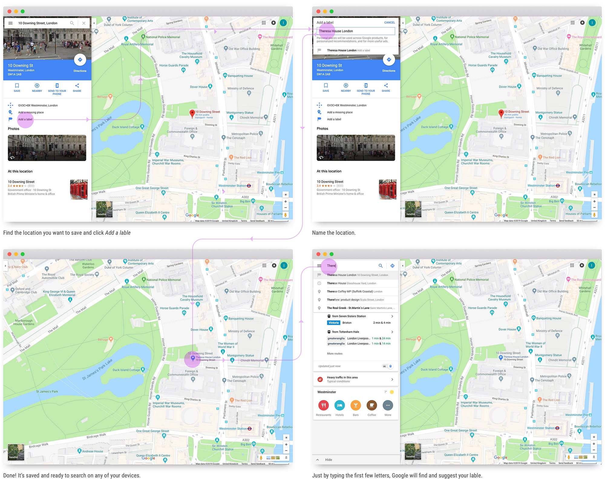
Adding Labels and Favorite Locations
Google Maps allows users to personalize their navigation experience by adding labels and saving favorite locations. These features streamline access to frequently visited places and enhance the overall usability of the app.
Adding Labels:
- How to Add Labels: Search for a location, tap on it, and select the “Add label” option to assign a custom name.
- Customization Options: Use custom names or choose from suggested labels like “Home,” “Work,” or “Gym” for easy identification.
- Search Efficiency: Labeled locations appear prominently in search results, making it quicker to find places you visit often.
Favorite Locations:
- Save Favorites: Mark locations as favorites by adding them to lists such as “Favorites,” “Want to Go,” or custom lists created by the user.
- Organize Places: Use different lists to categorize locations based on purpose, such as dining, shopping, or travel.
- Quick Access: Access saved places quickly from the “Saved” tab, eliminating the need to search for frequently visited spots repeatedly.
Benefits:
- Personalization: Tailors the app to your specific needs and preferences, enhancing user satisfaction.
- Efficiency: Saves time by providing quick access to important and frequently visited locations.
- Enhanced Navigation: Simplifies the process of navigating to favorite spots without the need for manual entry each time.
Comparison Table: Google Maps Labels vs. Facebook Places
| Feature | Google Maps Labels | Facebook Places |
|---|---|---|
| \*\*Customization\*\* | High, with user-defined labels | Limited to predefined categories |
| \*\*Integration with Social Media\*\* | Limited, primarily within Google services | High, integrates with Facebook profiles |
| \*\*Accessibility\*\* | Accessible across all Google Maps platforms | Accessible through Facebook app only |
| \*\*Search Efficiency\*\* | High, labels appear in search results | Moderate, depends on Facebook network |
| \*\*Privacy Controls\*\* | Comprehensive, user-defined sharing options | Dependent on Facebook privacy settings |
While Facebook Places focuses on social integration and sharing locations within its network, Google Maps Labels offer greater customization and flexibility, making them more suitable for personal navigation and organization purposes.
Offline Maps for Traveling Without Internet
Google Maps’ offline maps feature ensures that users can navigate without relying on an internet connection, making it an essential tool for travelers venturing into areas with limited connectivity.
How to Download Offline Maps:
- Open Google Maps: Ensure you’re signed in to your Google account.
- Tap on Your Profile Picture: Located in the top-right corner.
- Select “Offline Maps”: Navigate to the offline maps section.
- Choose Your Area: Select the region you intend to download. You can zoom in or out to adjust the area covered.
- Download the Map: Confirm the selection to begin downloading the chosen area for offline use.
Using Offline Maps:
- Activate Navigation: Once downloaded, open Google Maps and select the offline map for navigation. Turn-by-turn directions will function without an internet connection.
- Search and Browse: Search for locations and browse maps within the downloaded area, even when offline.
- Automatic Updates: Offline maps periodically update when connected to the internet, ensuring they remain current.
Benefits:
- Reliable Navigation: Navigate seamlessly in areas with poor or no internet coverage, such as remote regions or during travel abroad.
- Cost Efficiency: Avoid data roaming charges by using downloaded maps without needing an active data connection.
- Preparedness: Be prepared for unexpected connectivity issues, ensuring you always have access to essential navigation tools.
Comparison List: Google Maps Offline Maps vs. HERE WeGo Offline Maps
| Feature | Google Maps Offline Maps | HERE WeGo Offline Maps |
|---|---|---|
| \*\*Download Flexibility\*\* | Select specific areas | Download entire countries or regions |
| \*\*Update Mechanism\*\* | Automatic updates when online | Manual updates required |
| \*\*Features Available Offline\*\* | Turn-by-turn navigation, search | Turn-by-turn navigation, public transit |
| \*\*Storage Requirements\*\* | Customizable based on selected areas | More comprehensive, requiring more storage |
| \*\*Map Detail\*\* | High detail within selected areas | Extensive detail across entire regions |
While HERE WeGo offers the advantage of downloading entire regions, Google Maps provides customizable offline maps that allow users to download specific areas as needed. This flexibility makes Google Maps a more adaptable solution for those who want to manage their storage space efficiently while traveling.

Comparing Google Maps with Other Navigation Apps
While Google Maps holds a prominent position in the navigation app market, it’s essential to understand how it stacks up against other popular navigation tools. Comparing features, accuracy, and usability across different applications like Waze, Apple Maps, and HERE WeGo provides valuable insights into which tool best suits specific user needs.
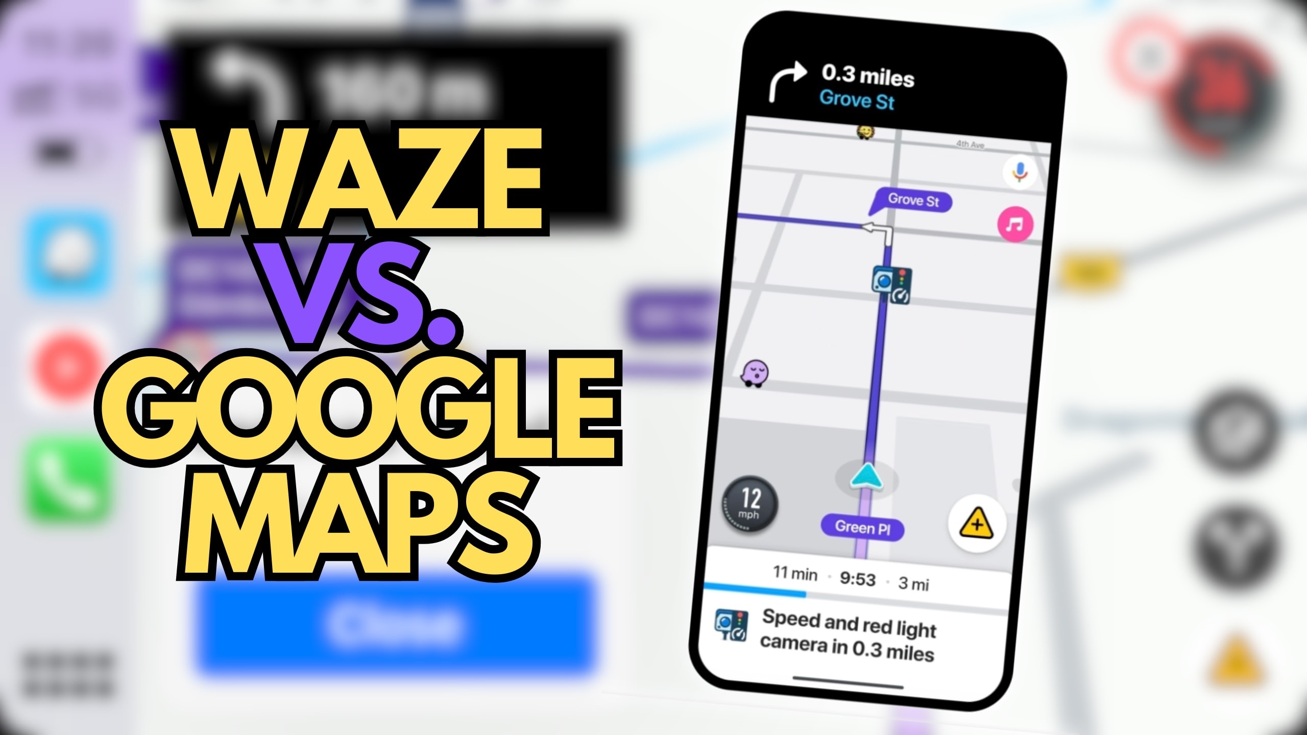
Google Maps vs. Waze: Which is Better for Driving?
When it comes to driving, both Google Maps and Waze offer robust navigation solutions, each with its unique strengths and features. Understanding the differences can help users choose the app that best fits their driving preferences and needs.
Google Maps Driving Features:
- Comprehensive Data Integration: Combines user data with extensive traffic information from various sources for accurate navigation.
- AI-Powered Route Planning: Utilizes artificial intelligence to suggest the most efficient routes, considering real-time traffic and road conditions.
- Seamless Integration: Integrates with other Google services like Calendar and Assistant, enhancing the overall user experience.
- Offline Maps: Provides offline navigation capabilities, ensuring reliability even without internet access.
Waze Driving Features:
- Community-Driven Data: Heavily relies on user-generated reports for real-time traffic updates, including accidents, hazards, and police presence.
- Social Features: Allows users to share their location, see friends’ movements, and engage with the community for a more interactive experience.
- Customization Options: Offers various customization features like voice packs and app themes, allowing users to personalize their navigation experience.
- Fuel Prices and Stations: Provides information on nearby gas stations with fuel prices, helping drivers find the best deals.
Comparison Table: Google Maps vs. Waze for Driving
| Feature | Google Maps | Waze |
|---|---|---|
| \*\*Data Sources\*\* | Diverse, including GPS, sensors | Primarily user-generated reports |
| \*\*Community Interaction\*\* | Limited to reviews and updates | High, real-time user interactions |
| \*\*Route Accuracy\*\* | Highly accurate with AI integration | Accurate based on user reports |
| \*\*Customization\*\* | Basic customization options | Extensive customization with voice packs and themes |
| \*\*Offline Navigation\*\* | Yes, with pre-downloaded maps | Limited, relies heavily on live data |
Which is Better for Driving?
- Google Maps: Ideal for users who seek comprehensive data integration, high route accuracy, and seamless integration with other Google services. It’s especially beneficial for those who prefer a straightforward navigation experience without heavy reliance on community input.
- Waze: Best suited for drivers who value real-time, community-driven updates and enjoy engaging with a user community. Its social features and customization options make it a favorite among younger drivers and those who frequently encounter dynamic traffic conditions.
Personal Opinion: While Waze offers a more interactive and community-based navigation experience, Google Maps provides a more reliable and comprehensive driving solution, especially for long-distance travel and users who integrate it with other Google services. The choice ultimately depends on individual preferences for data sources and community interaction.
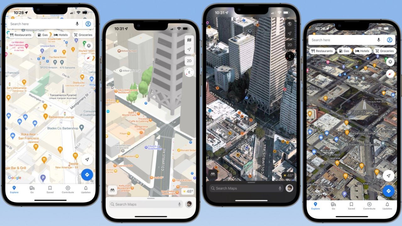
Google Maps vs. Apple Maps: Accuracy and Features Comparison
Apple Maps has made significant strides since its introduction, but how does it compare to Google Maps in terms of accuracy and features? This comparison highlights the strengths and weaknesses of each app, helping users decide which one best meets their navigation needs.
Google Maps Features:
- Extensive Data Coverage: Covers virtually every location worldwide with detailed maps and information.
- Street View and 3D Mapping: Provides immersive street-level and three-dimensional views, enhancing visual navigation.
- Public Transportation Integration: Offers comprehensive public transit schedules and multimodal transportation options.
- User-Generated Content: Includes reviews, photos, and editable information contributed by users.
Apple Maps Features:
- Apple Ecosystem Integration: Seamlessly integrates with other Apple services like Siri, Apple Watch, and CarPlay.
- Privacy-Focused: Emphasizes user privacy by anonymizing data and minimizing data collection.
- Enhanced Visuals: Offers high-quality 3D Flyover and Look Around features for detailed visual navigation.
- Natural Language Processing: Better understands natural language queries, allowing for more intuitive searches.
Comparison Table: Google Maps vs. Apple Maps
| Feature | Google Maps | Apple Maps |
|---|---|---|
| \*\*Data Coverage\*\* | Extensive global coverage | Growing, but less extensive than Google Maps |
| \*\*Street View vs. Look Around\*\* | Street View with panoramic images | Look Around with high-resolution visuals |
| \*\*Public Transportation\*\* | Comprehensive schedules and options | Limited in some regions |
| \*\*Integration with Services\*\* | High within Google ecosystem | High in Apple ecosystem |
| \*\*Privacy Features\*\* | Standard data collection practices | Advanced privacy controls |
Accuracy Comparison: Google Maps generally offers more accurate and up-to-date maps, especially in regions outside the United States. Its extensive data sources and user contributions ensure that maps are continuously updated with the latest information. Apple Maps, while improving rapidly, still lags in certain areas, particularly in less densely populated regions, where Google Maps provides more reliable navigation.
Feature Comparison:
- Google Maps: Excels with features like Street View, comprehensive public transit integration, and a vast database of user-generated content, making it a versatile tool for various navigation needs.
- Apple Maps: Shines in its integration with the Apple ecosystem and privacy-focused features. Its advanced visual capabilities like Flyover and Look Around provide a superior visual experience, particularly for iOS users.
Personal Opinion: Google Maps remains the leader in accuracy and feature richness, offering a more reliable navigation experience globally. However, Apple Maps provides a more polished and user-friendly interface for Apple device users, with strong privacy protections and seamless integration within the Apple ecosystem. The choice between the two often depends on the user’s device ecosystem and specific navigation needs.
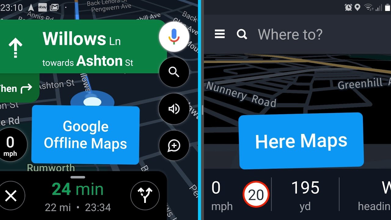
Google Maps vs. HERE WeGo: Offline Navigation and Usability
When comparing offline navigation capabilities and usability, Google Maps and HERE WeGo emerge as two of the most robust contenders. Each offers unique advantages that cater to different user preferences and requirements.
Google Maps Offline Navigation:
- Selective Area Downloads: Users can download specific areas, cities, or regions, allowing for tailored offline access based on their travel plans.
- Turn-by-Turn Directions: Provides accurate navigation without internet access, including walking and driving directions.
- Search Functionality: Allows users to search for locations within downloaded offline maps, enabling effective navigation without data connectivity.
- Regular Updates: Offline maps update automatically when connected to the internet, ensuring they remain current and accurate.
HERE WeGo Offline Navigation:
- Comprehensive Offline Coverage: Users can download entire countries or continents, offering extensive offline navigation without the need for multiple downloads.
- Public Transit Support: Includes detailed public transit information and navigation capabilities even when offline.
- Fuel Prices and Hotels: Provides additional offline features like fuel prices and hotel locations, enhancing travel planning.
- Low Data Usage: Optimizes offline maps to consume less storage space while maintaining detailed navigation capabilities.
Comparison Table: Google Maps vs. HERE WeGo Offline Navigation
| Feature | Google Maps Offline Navigation | HERE WeGo Offline Navigation |
|---|---|---|
| \*\*Download Flexibility\*\* | Specific areas, cities, regions | Entire countries, continents |
| \*\*Navigation Features\*\* | Turn-by-turn driving and walking | Turn-by-turn driving, walking, public transit |
| \*\*Additional Offline Features\*\* | Limited to navigation | Fuel prices, hotel locations |
| \*\*Storage Efficiency\*\* | Requires multiple downloads for extensive areas | More storage-efficient for large regions |
| \*\*Update Mechanism\*\* | Automatic when online | Manual updates |
Usability Comparison:
- Google Maps: Offers a user-friendly interface with easy-to-download specific areas, making it ideal for users who need offline access to select locations. Its integration with other Google services enhances overall usability.
- HERE WeGo: Provides more extensive offline coverage, making it suitable for international travelers who need comprehensive map access without worrying about multiple downloads. Its additional features like fuel prices and hotel locations add value for road trips and travel planning.
Common Issues with Google Maps Offline Navigation:
- Inaccuracies in Routing: Occasionally, routing may be less accurate in less populated areas.
- Offline Map Sufficiency: Users might find the selected offline areas insufficient for expansive travel needs.
- Automatic Rerouting: Sometimes, the app may override user-selected routes without options to disable auto-rerouting.
Benefits of HERE WeGo:
- Broad Coverage: Ideal for long-distance travelers needing extensive map access.
- Comprehensive Features: Extras like fuel prices and hotel locations provide a well-rounded travel tool.
- Efficiency: Optimizes storage usage, allowing for extensive maps without consuming excessive device memory.
Overall, both Google Maps and HERE WeGo offer strong offline navigation capabilities, each with its unique strengths. Google Maps is better suited for users who prefer specific area downloads and seamless integration with Google services, while HERE WeGo excels in offering extensive offline coverage and additional travel planning features.
Troubleshooting and Common Issues with Google Maps
While Google Maps is a robust and reliable navigation tool, users may occasionally encounter issues that can hinder their experience. Understanding how to troubleshoot these common problems ensures a smoother and more efficient use of the app.
Fixing GPS Location Errors
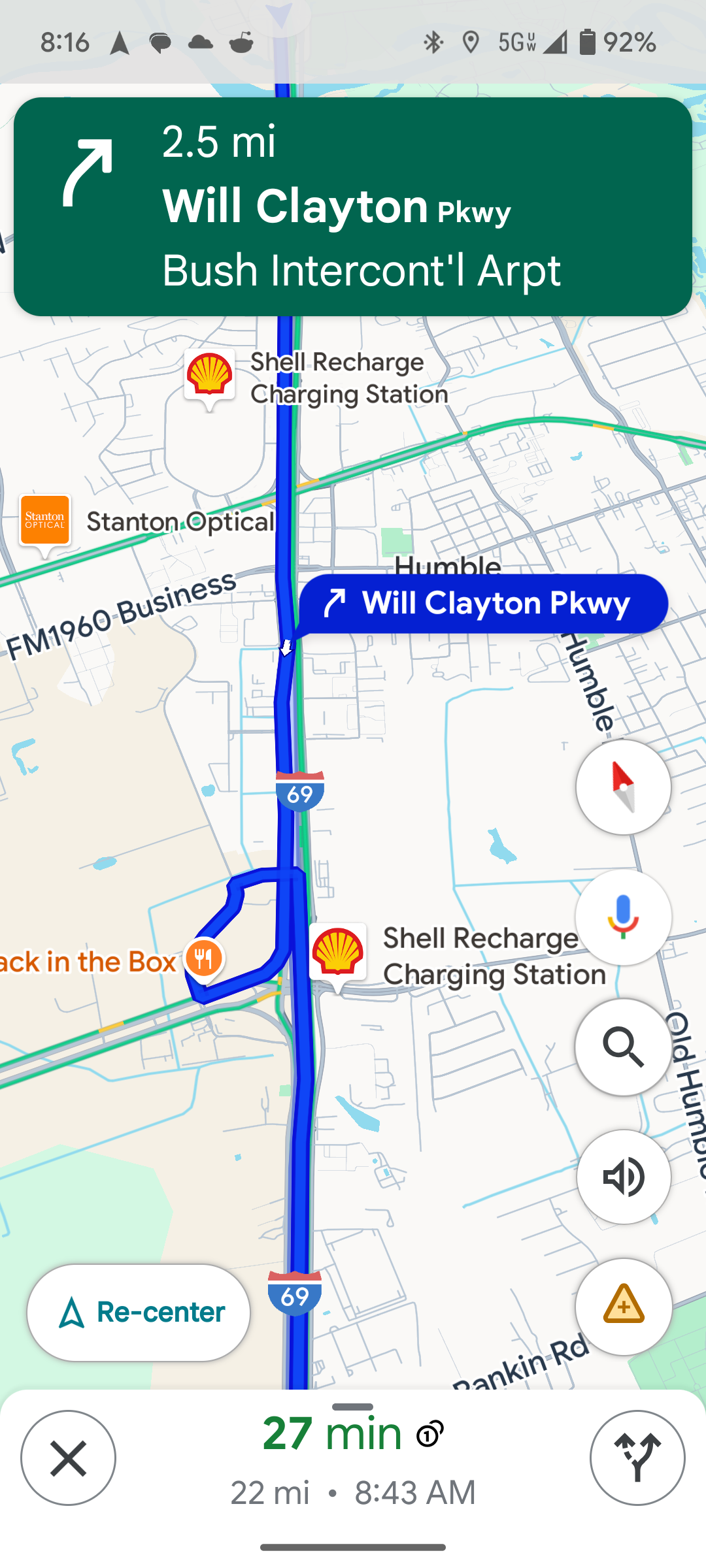
GPS location errors can significantly disrupt navigation, making it essential to address them promptly to ensure accurate map positioning and routing.
Common GPS Location Issues:
- Incorrect Location: The app shows the wrong location on the map.
- GPS Signal Lost: The app frequently loses GPS signal, causing intermittent navigation issues.
- Delayed Location Updates: The map takes time to update the user’s current location.
Troubleshooting Steps:
- Enable Location Services:
- Ensure that Location Services are enabled on your device.
- For Android: Go to Settings > Location > Enable Location and select “High Accuracy.”
- For iOS: Go to Settings > Privacy > Location Services > Enable Location Services for Google Maps.
- Check Internet Connection:
- Ensure that your device has a stable internet connection, as GPS accuracy improves with data.
- Calibrate Compass:
- On Android, open Google Maps, move your device in a figure-eight motion to recalibrate the compass.
- On iOS, go to Settings > Privacy > Location Services > System Services > Compass Calibration and enable it.
- Clear App Cache and Data:
- For Android: Go to Settings > Apps > Google Maps > Storage > Clear Cache and Clear Data.
- For iOS: Uninstall and reinstall the Google Maps app to clear cached data.
- Restart Your Device:
- Restarting can refresh system settings and resolve minor glitches affecting GPS functionality.
- Update Google Maps:
- Ensure that you have the latest version of Google Maps installed, as updates often fix GPS-related bugs.
Advanced Solutions:
- Reset Network Settings:
- Sometimes, resetting network settings can resolve persistent GPS issues by refreshing the connection.
- Go to Settings > System > Reset > Reset Network Settings (Android) or Settings > General > Reset > Reset Network Settings (iOS).
- Enable Google Location Accuracy (Android):
- Go to Settings > Location > Google Location Accuracy and ensure it’s enabled for improved GPS performance.
- Disable Battery Saving Modes:
- Battery-saving modes can restrict GPS accuracy. Disable them while using Google Maps for navigation.
Comparison List: Google Maps GPS Fix Methods vs. Generic GPS Fix Methods
| Fix Method | Google Maps Specific Steps | Generic GPS Fix Methods |
|---|---|---|
| \*\*Enable Location Services\*\* | High Accuracy in Google Maps settings | General device location settings |
| \*\*Calibrate Compass\*\* | Specific gestures within Google Maps | Device-wide compass calibration |
| \*\*Clear App Cache/Data\*\* | Through Google Maps app settings | Through device app settings |
| \*\*Reset Network Settings\*\* | May impact all apps, not just Google Maps | Universal for all connectivity issues |
By following these troubleshooting steps, users can effectively resolve most GPS location errors in Google Maps, ensuring accurate and reliable navigation.
Resolving Slow Performance and App Crashes
Encountering slow performance or app crashes can be frustrating, particularly when you rely on Google Maps for navigation. Addressing these issues promptly can restore the app’s functionality and enhance user experience.
Common Performance Issues:
- Slow Loading Times: Google Maps takes longer than usual to load or respond.
- App Crashes: The app unexpectedly closes during use.
- Lagging Interface: Navigational elements and maps move sluggishly.
Troubleshooting Steps:
- Update Google Maps:
- Ensure you have the latest version of Google Maps installed from the Google Play Store or Apple App Store, as updates may include performance enhancements and bug fixes.
- Clear App Cache and Data:
- For Android: Go to Settings > Apps > Google Maps > Storage > Clear Cache and Clear Data.
- For iOS: Uninstall and reinstall the app to clear cached data.
- Restart Your Device:
- Restarting can resolve temporary system glitches affecting app performance.
- Free Up Storage Space:
- Ensure your device has sufficient storage space by deleting unused apps, clearing cache data, or removing unnecessary files.
- Close Background Apps:
- Close other apps running in the background to free up system resources and improve Google Maps performance.
- Check for System Updates:
- Make sure your device’s operating system is up-to-date, as system updates can improve overall performance and compatibility.
- Disable Unnecessary Features:
- Turn off features like background data usage or location accuracy settings that may be taxing the app.
Advanced Solutions:
- Reinstall Google Maps:
- Uninstalling and reinstalling the app can resolve deeper issues related to corrupted files or settings configurations.
- Monitor App Permissions:
- Ensure Google Maps has all the necessary permissions to function correctly, including location, storage, and internet access.
- Factory Reset (Last Resort):
- If persistent issues remain, a factory reset may be necessary, though this should be a last resort due to the data loss involved.
Comparison Table: Google Maps Performance Fixes vs. General App Performance Fixes
| Fix Method | Google Maps Specific Steps | General App Performance Fixes |
|---|---|---|
| \*\*Update the App\*\* | Check Google Play Store/App Store | Update from app store |
| \*\*Clear Cache/Data\*\* | Through Google Maps app settings | Through device app settings |
| \*\*Restart Device\*\* | Uniform approach | Universal for all apps |
| \*\*Free Up Storage\*\* | Optimize specifically for Google Maps usage | General storage management |
| \*\*Reinstall the App\*\* | Uninstall and reinstall Google Maps | Uninstall and reinstall affected app |
By systematically addressing these common performance and crash issues, users can restore Google Maps to its optimal functionality, ensuring reliable and smooth navigation experiences.
How to Update Google Maps for the Latest Features
Keeping Google Maps updated is essential for accessing the latest features, improvements, and security enhancements. Regular updates ensure that the app functions smoothly and incorporates the newest navigation technologies.
Steps to Update Google Maps:
For Android Users:
- Open Google Play Store: Locate and launch the Google Play Store app on your Android device.
- Access “My Apps & Games”: Tap on the three horizontal lines in the top-left corner to open the menu, then select “My apps & games.”
- Find Google Maps: Scroll through the list to find “Google Maps.”
- Tap “Update”: If an update is available, tap the “Update” button next to Google Maps. The app will begin updating automatically.
For iOS Users:
- Open App Store: On your iPhone or iPad, launch the App Store.
- Go to “Updates”: Tap on your profile picture in the top-right corner to access updates.
- Find Google Maps: Scroll through the list to locate “Google Maps.”
- Tap “Update”: If an update is available, tap the “Update” button. The app will download and install the latest version.
Common Issues During Updates:
- Insufficient Storage Space: Ensure your device has enough free space by deleting unused apps or files.
- Poor Internet Connectivity: Ensure you have a stable internet connection, preferably via Wi-Fi, to download updates smoothly.
- App Store Glitches: If updates aren’t appearing, try restarting the app store or your device to refresh the interface.
Post-Update Troubleshooting:
- Clear Cache and Data: If Google Maps isn’t functioning correctly after an update, clear the app’s cache and data or reinstall the app.
- Check Permissions: Ensure that Google Maps has the necessary permissions to operate effectively, such as access to location and storage.
- Verify Settings: After updating, review your Google Maps settings to ensure feature configurations haven’t reset or changed.
Benefits of Regular Updates:
- Access to New Features: Stay ahead with the latest navigation technologies and user interface enhancements.
- Improved Performance: Benefit from bug fixes and performance optimizations that make the app run more smoothly.
- Enhanced Security: Protect your device and data with the latest security patches and updates.
Comparison List: Google Maps Update Process vs. General App Updates
| Step | Google Maps Update | General App Updates |
|---|---|---|
| \*\*Accessing Update\*\* | Via Google Play Store/App Store | Via respective app stores |
| \*\*Installation Process\*\* | Tap “Update” within the app store | Similar across most apps |
| \*\*Post-Update Actions\*\* | Clear cache/data if issues persist | Similar troubleshooting steps |
| \*\*Frequency of Updates\*\* | Regular, with frequent feature additions | Varies by app and developer |
| \*\*Size of Updates\*\* | Can vary depending on new features | Varies by app and new features |
By regularly updating Google Maps, users ensure they are leveraging the full potential of the app, benefiting from continuous improvements and the latest navigation innovations.
FAQs
1. Can I use Google Maps without an internet connection? Yes, Google Maps allows users to download offline maps, enabling navigation without an active internet connection. This feature is particularly useful when traveling to areas with limited connectivity.
2. How accurate is Google Maps for indoor navigation? Google Maps offers indoor maps for many large venues such as airports, shopping malls, and museums. However, the accuracy may vary depending on the building’s infrastructure and the availability of detailed indoor mapping data.
3. Does Google Maps consume a lot of battery power? Using Google Maps for navigation can consume significant battery power, especially with continuous GPS usage. To conserve battery, users can reduce screen brightness, close other apps, or use offline maps when streaming data isn’t necessary.
4. How can I contribute to improving Google Maps? Users can contribute by adding reviews, uploading photos, suggesting edits to map locations, and reporting inaccuracies. These contributions help enhance the accuracy and richness of the map data for all users.
5. Is Google Maps free to use? Yes, Google Maps is free to use on both Android and iOS devices. Some advanced features, like downloading offline maps, may require additional data usage, but the basic functionality remains free.
Key Takeaways
Comprehensive Navigation Tool: Google Maps offers a wide range of features catering to different navigation and mapping needs.
Real-Time Data Integration: Provides up-to-date traffic information, live transit schedules, and real-time updates for accurate and efficient navigation.
Customization and Personalization: Users can create custom maps, save favorite locations, and add labels for a tailored navigation experience.
Offline Capabilities: Offline maps ensure reliable navigation even in areas with poor or no internet connectivity.
Business Integration: Enhances local businesses’ visibility through detailed listings, reviews, and interactive features.
Comparative Advantage: Outperforms competitors like Waze and Apple Maps in features, data accuracy, and integration with other services.
User Contributions: Encourages user-generated content to continuously improve map accuracy and enrich the user experience.
Regular Updates and Innovations: Continuous updates ensure that Google Maps remains at the forefront of navigation technology, incorporating the latest advancements and user feedback.
Conclusion
Google Maps has undeniably transformed the landscape of navigation and mapping, offering a comprehensive tool that caters to a diverse range of users and use cases. Its blend of advanced features like real-time GPS navigation, live traffic updates, immersive street views, and extensive offline capabilities make it an indispensable resource for daily commuting, travel planning, and business operations.
One of the most remarkable aspects of Google Maps is its ability to adapt and evolve. By continuously integrating user feedback and harnessing the power of artificial intelligence, Google Maps ensures that it remains at the forefront of navigation technology. This adaptability is further enhanced by its seamless integration with other Google services, providing a cohesive and user-friendly ecosystem.
Furthermore, the app’s dedication to user customization and data accuracy sets it apart from competitors. Whether you’re creating a custom map for a comprehensive trip itinerary, tracking your travel history, or optimizing driving routes for efficiency, Google Maps offers the tools and reliability needed to meet your specific needs.
In comparison with other navigation apps like Waze, Apple Maps, and HERE WeGo, Google Maps consistently demonstrates superior coverage, feature integration, and user satisfaction. While each app has its own strengths, Google Maps’ holistic approach and continuous innovation ensure its position as the leading navigation tool globally.
As technology advances and our reliance on digital navigation grows, Google Maps remains a testament to how powerful and versatile a mapping tool can be. Its ability to combine functionality, accuracy, and user-centric design makes it an essential companion for navigating the world, both digitally and physically.

